


India–Bangladesh Border Length, Indian States Involved, and Key Geographic Facts
India shares a long and historically significant international boundary with Bangladesh. This border is one of the longest land boundaries that India shares with any neighboring country. The India - Bangladesh boundary plays a crucial role in geography, international relations, security, trade, and cultural exchange. Understanding this boundary is important for students preparing for competitive exams and general knowledge studies, as it frequently appears in questions related to Indian geography and international relations.
Overview of India - Bangladesh Border
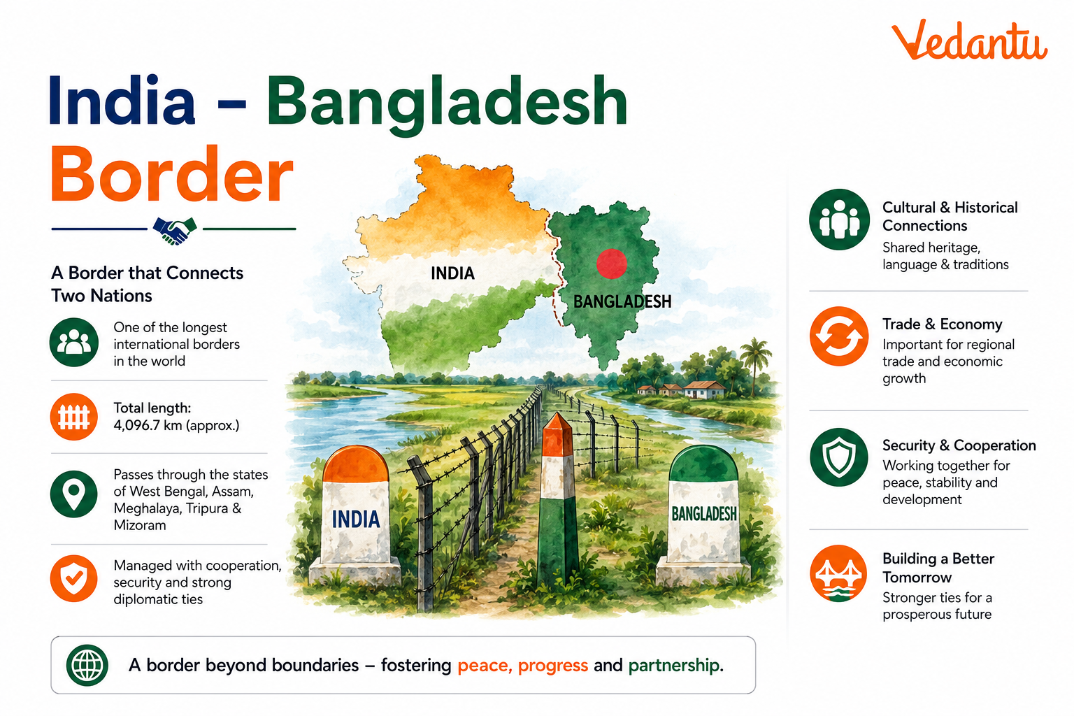
The total length of the India - Bangladesh border is approximately 4,096.7 kilometers, making it the longest international border that India shares with any country. Bangladesh is almost surrounded by India on three sides - west, north, and east. The boundary was largely determined during the partition of India in 1947 under the Radcliffe Line.
- Total border length - 4,096.7 km
- Type of border - International land border and riverine border
- Historical origin - Radcliffe Line (1947)
- Managed by - Border Security Force (BSF) on the Indian side
Indian States Sharing Boundary with Bangladesh
Five Indian states share a boundary with Bangladesh. These states are located in the eastern and northeastern part of India. West Bengal shares the longest boundary with Bangladesh.
Indian States Bordering Bangladesh
| State | Border Length (Approx.) | Direction from Bangladesh |
|---|---|---|
| West Bengal | 2,216 km | West |
| Tripura | 856 km | East |
| Meghalaya | 443 km | North |
| Assam | 263 km | North |
| Mizoram | 318 km | East |
West Bengal shares the longest stretch of border, which makes it strategically and economically important. Tripura is almost surrounded by Bangladesh on three sides, making border relations especially significant for this state.
Nature of the Border
Land Border
A large portion of the boundary is a land border that passes through plains, forests, hills, and agricultural fields. Fencing has been constructed along most parts of the border to prevent illegal activities and ensure security.
Riverine Border
Some parts of the India - Bangladesh boundary pass through rivers such as the Ganga, Brahmaputra, and Teesta. These riverine sections are more difficult to monitor due to changing river courses and erosion.
Historical Background
The India - Bangladesh boundary originated during the partition of British India in 1947. At that time, Bangladesh was known as East Pakistan. The boundary was drawn by Sir Cyril Radcliffe and came to be known as the Radcliffe Line. In 1971, after the Bangladesh Liberation War, East Pakistan became the independent nation of Bangladesh.
One major issue between the two countries was the presence of enclaves. These were small pockets of land belonging to one country but located inside the territory of the other. This issue was resolved through the Land Boundary Agreement of 2015, which allowed the exchange of enclaves and simplified the border.
Strategic and Economic Importance
The India - Bangladesh border holds great strategic, economic, and cultural importance. It influences trade, security, and people-to-people connections between the two nations.
- Facilitates cross-border trade through several land ports
- Important for regional connectivity in Northeast India
- Helps in cultural exchange due to shared language and traditions, especially in West Bengal and Tripura
- Strategically significant for national security and border management
Major Border Checkpoints and Trade Routes
Several Integrated Check Posts and Land Customs Stations operate along the India - Bangladesh border to regulate trade and movement of people.
- Petrapole - Benapole (West Bengal) - Largest land port in South Asia
- Agartala - Akhaura (Tripura)
- Dawki - Tamabil (Meghalaya)
- Sutarkandi (Assam)
Challenges Along the Border
Despite strong diplomatic relations, the border faces several challenges due to its length and geographical diversity.
- Illegal migration
- Smuggling of goods and cattle
- Human trafficking
- River erosion changing boundary lines
Key Facts for Competitive Exams
- Bangladesh shares the longest land border with India
- Total length - 4,096.7 km
- Five Indian states share boundary with Bangladesh
- Land Boundary Agreement signed in 2015
- Radcliffe Line demarcated the boundary in 1947
Conclusion
The India - Bangladesh boundary is not only the longest international border of India but also one of the most significant in terms of geography, history, economy, and security. It connects diverse cultures and plays a crucial role in the development of eastern and northeastern India. For students and competitive exam aspirants, understanding the states involved, border length, historical background, and strategic importance is essential for mastering this important General Knowledge topic.
FAQs on India Share Boundaries With Bangladesh – Detailed Explanation for Students
1. Which Indian states share boundaries with Bangladesh?
India shares its boundary with Bangladesh through five eastern and northeastern states. West Bengal, Assam, Meghalaya, Tripura, and Mizoram share an international border with Bangladesh.
• West Bengal – Longest stretch of the border
• Assam – Shares riverine and land boundaries
• Meghalaya – Hilly border areas
• Tripura – Surrounded on three sides by Bangladesh
• Mizoram – Southernmost bordering state
This boundary is part of the larger India–Bangladesh international border, important for trade, security, and cultural exchange.
2. What is the total length of the India-Bangladesh border?
The total length of the India–Bangladesh border is approximately 4,096.7 kilometers, making it India’s longest international boundary.
• Longest border India shares with any country
• Includes both land and riverine (water) boundaries
• Extends across five Indian states
This extensive boundary plays a key role in border management, security, and bilateral relations between the two nations.
3. Which Indian state shares the longest border with Bangladesh?
Among Indian states, West Bengal shares the longest border with Bangladesh.
• Border length: Around 2,216 km
• Covers districts like North 24 Parganas, Nadia, Murshidabad, and Cooch Behar
• Includes important land ports such as Petrapole
West Bengal’s border is significant for trade, migration, and cultural ties between India and Bangladesh.
4. Why is the India-Bangladesh border important?
The India-Bangladesh border is important due to its strategic, economic, and cultural significance.
• Facilitates bilateral trade and commerce
• Ensures national security and border management
• Supports cross-border cultural and historical ties
• Connects Northeast India to the mainland
It is frequently discussed in GK, UPSC, SSC, and competitive exams under topics like international relations and Indian geography.
5. What agreement resolved the border disputes between India and Bangladesh?
The Land Boundary Agreement (LBA) 2015 resolved long-standing border disputes between India and Bangladesh.
• Signed during Prime Minister Narendra Modi’s visit
• Exchange of enclaves (Chitmahals)
• Settlement of adverse possessions
• Improved bilateral relations
The agreement strengthened India–Bangladesh diplomatic relations and simplified border demarcation.
6. What are enclaves in the India-Bangladesh border context?
Enclaves were small pieces of land belonging to one country but located inside the territory of the other country.
• Also called Chitmahals
• Created historical administrative complications
• Exchanged under the 2015 Land Boundary Agreement
The removal of enclaves helped in better governance, citizenship rights, and border clarity.
7. Which river forms part of the India-Bangladesh boundary?
Several rivers form parts of the India–Bangladesh international border, with the Ganga (Padma) and Brahmaputra being the most important.
• Ganga/Padma River
• Brahmaputra River
• Teesta River
Riverine boundaries create challenges in water sharing, flooding, and border security, often discussed in geography and current affairs.
8. How does Tripura’s location make it unique in relation to Bangladesh?
Tripura is unique because it is surrounded by Bangladesh on three sides.
• Shares around 856 km border with Bangladesh
• Connected to mainland India by a narrow corridor
• Important for connectivity and trade routes
This geographical position makes Tripura strategically important in India–Bangladesh relations and Northeast connectivity.
9. When did Bangladesh become independent from Pakistan?
Bangladesh became independent on 16 December 1971 after the Bangladesh Liberation War.
• Formerly known as East Pakistan
• Supported by India during the war
• Led to formation of the new nation Bangladesh
This event significantly shaped the modern India–Bangladesh border and diplomatic relations.
10. What security force guards the India-Bangladesh border?
The Border Security Force (BSF) guards the India-Bangladesh border.
• Established in 1965
• Prevents illegal immigration and smuggling
• Maintains border fencing and surveillance
On the Bangladesh side, the border is guarded by the Border Guard Bangladesh (BGB), ensuring coordinated border management.