


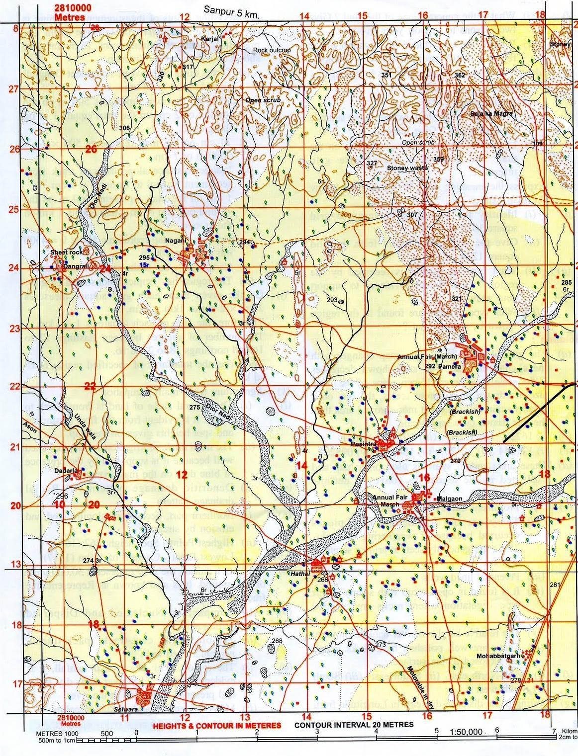
What do the following numbers in grid square 1718 and 1818 mean?
(i) 280.
Answer
585.6k+ views
Hint: The numbers marked in the grid box 1718 and 1818 are used to find the slope of the land in the topographical map and depends on the contour interval, which is generally 20 metres.
Complete Answer: Since the number 280 is mentioned in red colour in between a running free line of red colour, it denotes the contour height. This is due to the fact that red coloured free line is used to depict the contour height and also the red text in between that line denotes the contour height.
Note: The other kinds of height that are present on the map are triangulated height and spot height which are important for survey purposes.
Recently Updated Pages
Master Class 12 Business Studies: Engaging Questions & Answers for Success
Master Class 12 Biology: Engaging Questions & Answers for Success
Master Class 12 Chemistry: Engaging Questions & Answers for Success
Class 12 Question and Answer - Your Ultimate Solutions Guide
Master Class 11 Social Science: Engaging Questions & Answers for Success
Master Class 11 English: Engaging Questions & Answers for Success
Trending doubts
Explain the Treaty of Vienna of 1815 class 10 social science CBSE
Which Indian city is known as the "City of Victory"?
Which instrument is used to measure the Blood Pressure?
Who Won 36 Oscar Awards? Record Holder Revealed
What is the median of the first 10 natural numbers class 10 maths CBSE
Why is it 530 pm in india when it is 1200 afternoon class 10 social science CBSE